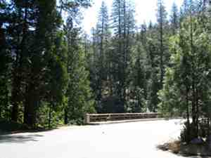
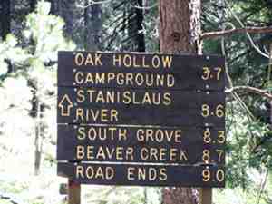
This is an introduction to the road leading to the South Grove trail and Beaver Creek access in Calaveras Big Trees State Park.
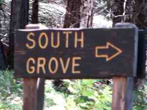
The road starts just inside the park entrance where, if you look straight ahead you’ll see the sign…
The road is well paved and wide enough for two cars to pass comfortably up until you get to the river where it narrows a bit. Even after that it’s still wide enough as long as you take is slow, keep on your side of the road, and watch out for bicycles.
A little less than two miles up the road, on the left, you’ll see a gated dirt road, and if you’re going slow enough, you’ll also see a small sign indicating that the area outside the gate is for e (environmental) camp parking only. If you happen to be visiting in the area you might want to know that the fire road behind the gate leads you to the Big Trees Village neighborhood.
A little further up the road, a little over two miles in, you’ll see a sign on the right for a scenic overlook.
 I would highly recommend that you take a few moments and check out the view from this overlook. It is really pretty spectacular.
The Oak Hollow camp ground is about four miles in from the start of the road. This is a nice campground far enough from the highway to reduce truck and motorcycle noise. It is also closer to fishing spots than the campground up near the park entrance.
As you go down the road into the campground, just to the left of the road you’ll see an open area and if you look closely you’ll see a small interpretive kiosk that will tell you a bit about the history of the area when it was occupied by Native Americans.
Shortly after you pass the campground, on the South Grove road, you’ll come across an unexpected sight… A pedestrian crossing sign and cross walk. There is a hiking trail that goes from the visitors center all the way down to the Stanislaus River. This is the first of two places where that trail crosses the South Grove Road.
At about the five mile mark, you’ll come to a sign on the right for Lava Bluffs. This is a relatively short interesting trail. I’ve not taken it yet, but I hear tell that there may be poison oak along some parts at some times of the year.
About a half mile after the Lava Bluffs trail head, you’ll come across the second River Trail pedestrian crossing that I mentioned earlier.
At a little under six miles, you’ll come to a sign for the River Picnic Area. This is a very nice picnic area and also provides easy river Access. The River Trail, that started near the Visitors Center, ends here. The trail from the last picnic area parking lots is well graded and if I am not mistaken it is wheel chair accessible. This river access trail is less than a quarter mile long but includes several benches along the way if you want to sit, rest, or just enjoy the sounds of the river and the forest.
Just past the River Picnic Area, at about six miles in, you’ll come to the river crossing. There are parking area on both sides of the river here. There is also river access though I do not believe it is as easy here as it is in the picnic area.
Once you cross the river, the road narrows a bit.
At a little under eight and a half miles in, if you keep your eyes open for it, you’ll see a small sign on the right indicating the Skull Creek Fire Station. There’s a fire road behind a locked gate that leads to the station. You would never know it looking around, but not too far down this road it turns to follow Beaver Creek. It’s a bit of a walk but very pretty. There is also some great mountain biking back o n thees fire roads.
 About 100 yards further down the South Grove Road, you come to the main attraction… The South Grove trail head. The South Grove trail is quite a bit longer than the North Grove Trail (near the Visitors Center), but it has the largest trees in the park. In case you didn’t know, the redwoods in Calaveras Big Trees State Park are Sequoiadendron giganteum (giant Sequoia). They were once thought to be of the same genus as the coast redwood (Sequoia sempervirens), but that is no longer the case. The giant sequoia don’t get as high as the coast redwood, but their girth is astounding.
At about nine miles in, you’ll come to the Beaver Creek Picnic area. The last time I was down there, there was a lot of construction and renovation going on. It is a great picnic area and I’m sure that once they get done it will be awesome. Evan as it is, it provides great access to Beaver Creek.
Finally, at just over nine and a quarter miles, you come to the end of the road. There’s parking, a vault toilet, and an easy loop to turn around to get back out. At the end of the road there’s a locked gate across a fire road. The fire road leads down to a bridge crossing Beaver Creek as well as a number of great hiking and mountain bike trails. This area is one of my favorites in the park!
Remember… some simple rules in the park:
- Mountain bikes on fire roads only! No off trail and no single track other than on foot.
- Dogs on leashes at all times.
- Dogs on paved or dirt roads only, not on the foot trails.
- Don’t take anything from the park, including pine cones, dogwood blossoms, rocks, etc.
- Enjoy yourself!
joe

Joe,
From the maps, it looks like the Calavaras Railroad trail departs somewhere from the South Grove Road. Can you identify that location for me? Thanks.
Rich
The original RR Grade Trail article was intended to be more of a test for how I had things set up. I’ll be updating that article soon with real directions, a better map, pictures, etc.
FYI, most of the articles that I’m publishing include a KML file that can be looked at in Google Earth, and a GPX file that can be transferred to many GPS devices.
As with any outdoor activity, use at your own risk! Know your own abilities, and be prepared.
joe